More big training miles this past week. My "Winter Coat" is starting to come off and I'm progressing toward my goal weight. I'm also coming down to the last few weeks of the school quarter, which means studying becomes a little hectic. Add in the holidays and it's easy to get overwhelmed. I have to remind myself to do one thing at a time and it'll all get done.
Saturday I met XC racer Chris down at Fiesta Island and we did the SDBC loop (not the group ride because it gets a little sketchy). It's a fairly scenic 50-miler that winds East into the Faribanks Ranch/ Rancho Santa Fe area before heading back to the coast in the So. Carlsbad area. Chatting wih Chris made the miles tick by much faster than whe I ride solo and I failed to look at my HRM throughout much of the ride. I got home and looked at the data: went WAY too hard. Oops! All told, a solid 4-hour ride. Sweet.
Saturday I met XC racer Chris down at Fiesta Island and we did the SDBC loop (not the group ride because it gets a little sketchy). It's a fairly scenic 50-miler that winds East into the Faribanks Ranch/ Rancho Santa Fe area before heading back to the coast in the So. Carlsbad area. Chatting wih Chris made the miles tick by much faster than whe I ride solo and I failed to look at my HRM throughout much of the ride. I got home and looked at the data: went WAY too hard. Oops! All told, a solid 4-hour ride. Sweet.
I woke up Sunday and got what I call "the urge". Every so often, I get that urge to do something slightly crazy and unorthodox. I was feeling Saturday's ride, but really wanted to get in an epic MTB ride somewhere besides my normal weekday rides. I was torn between Idyllwild and Noble Canyon. I had a limited amount of gas in my Jeep and no money to buy more. After doing the Google maps gas math ((gallons of gas x MPG) - round trip drive to trailhead) I settled on the Cuymaca-Noble Canyon ride.
I'd done this ride 2 years ago with riding buddies Ben and Craig, but wasn't sure I could remember all the turns. Luckily, I own a decent compass, I can read a topo map and mountain bike bill had the maps I needed. I got my stuff together, made a PB&J and went for it.
I knew I'd be pressed for daylight, but also knew I could knock this route out in 4 hours if I had to. I would have to since I got rolling at 12:20. This ride is SICK!

Around 31 miles and about 6k vertical. The idea was to see if I could pace myself at 8 mph (planned Vision Quest pace) and not kill myself. Even tired, I has enough gas that I could push it from the 12 mile mark all the way to the end, even on tired legs. Cool.
A view from the top of East Mesa fire road before heading over the ridge and into the Cleveland National Forest. The fire damage is from 2003 and there were lots of fallen snags on the downhill side of this (Deer Park Trail).
 Start of Indian Creek Trail. A rocky, nasty little climb that had me dabbing and even walking a few places. My full-squish would've helped here.
Once at the top of Indian Creek, I ran into some riding buddies (Ben included, ironically!) and we all came to the conclusion that I'd have to hustle to make it out by dark: it was already 2 and I had 18 miles to go. Uh oh...
So I said my goodbyes and put the hammer down; hence no more pictures :(. I was tired, but did not want to get stuck in the dark in the backcountry. Once at the bottom of Noble, I turned onto the second-nastiest pavement climb in the world (the on to the top of Southridge in Idyllwild is #1) and turned the jets on. I topped it out, turned left back onto Deer Creek and chased the sun. It retreated behind the ridge while I worked my way back up toward it. Thankfully, I won this time :). I made it back to the Jeep just in time for some pics of the sunset...
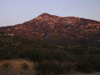
 ...and the accompanying alpenglow.
A great ending to a great weekend.
E.
 Looking back down the trail. The runner you can see is in the trail marathon: Blue Jay Camp, down Trabuco, up Holy Jim, across Main Divide back to Blue Jay...Sick!
 Ryan. Starting to feel not so great. He mentioned he might have had one too many Negro Modelos the night before. D'oh!
 Short hike-a-bike section as we reached the Main Divide.
 Me on the Main Divide with Holy Jim Canyon, that we just climbed out of, in the background.


 One of the many stream crossings on the way down Trabuco. These are technically challenging normally and even more so when they're running water in the rainy season. Some are not rideable. OK, maybe hans Rey could ride 'em...
 Looking down Trabuco Trail where we'd be going momentarily.
